The general outline was to go around Mt Hood via bike from hut to hut - duh! Each day's ride ended up at a hut that was fully stocked with food, water, etc...The cabins are pretty rustic, but felt like home in no time. No running water, no electricity, but plenty of food if you could find creative ways to cook with a random assortment of food goods.
The outfit that offers the self-guided tour was not very helpful beyond what literature they have on their site (which always leaves one wanting/needing more as questions arise). A couple of Erin's emails went unanswered but we figured we 'probably' had enough info to get from point A to point B to point C to point D and then back to point A again.
They had sent us 4 GPS files for the 4 days so we figured we were in pretty good hands and that once the files were downloaded to our GPS units, we would be in great hands. Fortunately, we had backup plans which included the written directions provided (which turned out to be a little book - something that is less than ideal when you have to carry everything you need for 4 days...and yes a small book does indeed impact the weight on your back, and more importantly, the weight on yo' tooshie).
We also decided to take along a couple of fold out maps that would collectively provide us the lay of the land.
We got up early on Thursday morning with the intent to drive from Bend to Hood River such that we could get riding between 9-10 a.m. The drive up was relatively uneventful except for the apocalyptic haze from the fires around Warm Springs. The further north we drove, the clearer it got and we felt relieved to see the skies were getting smoke free as we approached our destination of Hood River
As for directions and GPS, suffice it to say it was a good thing we had the written directions and the maps to references as the GPS files were not very dependable. We turned on our Garmins and started the course for day 1, only to realize they had sent us the wrong files. DOH! This could have been a really big deal if we did not have the backups and the backup to the backup on directions. The reason it could have been a big deal is there is a myriad of roads that have multiple turns in the backwoods where a wrong turn could easily put you in a bad spot with no water, etc.
OK, so we would have to ride by the written directions. We used rough odometer readings to follow the turn by turn directions as we left Hood River.
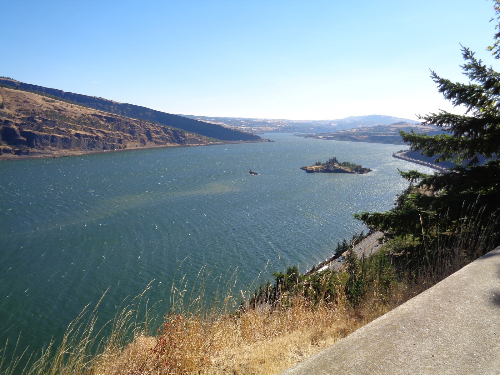
As luck would have it, we bumped into the other group that was signed up for the hut to hut bike-a-thon as we were unloading. After some quick intro's we hit the road and ended up riding together to the town of Mosier. This section was pretty mellow and very scenic as we rolled along the Columbia through some old tunnels. We know we had a big day of climbing ahead of us so we tried to enjoy the rollers while they lasted. Initial beta from the Hut to Hut crew said it would be a full belly of climbing with around 6,100 ft of elevation gain.
Soon enough we were in Mosier and navigated our way through a couple turns until we hit Husky road where things were about to get ummm 'hilly'!
We made a right hand turn and looked at the mouthful of climbing ahead of us. The grade pitched up and I immediately questioned the sanity of doing this hut to hut trip on the single speed (let alone on the ratio I had) while being loaded up with gear...hmmm, it was going to be a long 4 days of groveling...
After a little shock to the system, the body and mind got into the rhythm of climbing while being out of the saddle.
We followed a series of turns from the written directions and kept continuing to see great views of the surrounding mountains as we climbed. The higher we got, the better the views got. We had some nice views of Mt Hood, Adams, Rainier...pretty sweet indeed....it helped distract from the grind of climbing.
At some point we reached the hut up on Surveyor's ridge. As the hut came into view, we both relaxed a little and had a slight sense of relief and accomplishment. On paper, this was the biggest climbing day so we were happy to 'put it in the bank'. It ended up being around 5,100 ft of climbing in just under 26 miles...pretty solid day...
The unexpected surprise was seeing a couple of bikes as we rolled up to the hut. After removing helmets and gloves, the door opened and a couple of guys rolled out. It turns out they were getting ready for their second day of adventuring and were in the process of getting ready to leave for day 2 of riding. In the back of my mind, I was wondering whether they were cutting it a little close on time but figured they knew what lay ahead. After a few pleasantries, they ended up leaving about 30 minutes later and we had the hut to ourselves.
We quickly rummaged through the food and gobbled down some instant gratification as we settled in and got the lay of the land.
There was a short hike from the hut to a little scenic viewpoint (with a picnic table!) with a kick ass view of Mt Hood. We were happy to be there and took it all in.
A little later, the rest of the group of three ladies showed up and they too went through the process of getting settled in...we compared stories for the day and soon enough it was time to go watch the sun set from the viewpoint.
not a bad way to finish up....
some pix of the day's ride:


No comments:
Post a Comment