Friday, September 30, 2011

Euro Bail Out Beer Style

If are you like me, all this talk of Euro crisis and the Global financial recession has me scratching my head and wondering how it is all going down...alas, the simplified beer explanation:

Euro Bail Out Essssplained - Beer Style

just in time for OktoberFest!

Thursday, September 29, 2011

MTB: Big Hole Video

Video of the ride on another segment of the Bitterroot CDT

Big views, rugged terrain and rough riding.

Wednesday, September 28, 2011

MTB: BItterroot Pix 2

More pix from the ride on Sat:

at the saddle after some serious hike a bike - 360 degree views
 at the saddle - looking north
 saddle looking west
 saddle looking south
 descending - snow on some north facing slopes - great alpine views
 looking west on the descent
 getting ready to climb out of the trough again
 hard to keep the eyes on the trail with so much scenery!
 morning light

Tuesday, September 27, 2011

MTB: Bitterroot Pix 1

Below are some pix from our ride on Saturday - will post more tomorrow considering there were so many keepers!

The 'Roots' from afar....

 one of the many alpine lakes we went by on our first climb
 very peaceful and serene....the steep climbing soon to begin...
 after the first set of tightie, steep switchies looking back at the lake we just left:
 Hike a Bike - super steep hike a bike to gain the saddle:
 Looking back down the trail we just hiked up - wildflowers in full regalia!
 and what would it be without a good panoramic shot?
 Beautiful views helped to off-set the steep hike a bike action
part 2 of pix to follow tomorrow...also working on a vid of the day...

Monday, September 26, 2011

MTB: Bitterroot Big Hole Style

Despite Fall's official arrival on Friday, the temps remained summer-like.  We took advantage by packing up and heading back out to the hills.  We explored the Big Hole area and got on the CDT on new (to us) portions of the CDT in the Bitterroots.  This area has been the subject of much belly aching for cyclists as it has been on the chopping block as per our infinitely wise (sarcasm) government debating whether to declare it a Wilderness area (such designations do not permit biking).  Fortunately it has been held up in government bureaucracy while they determine what to do with the area.  When you go to places like this, it really makes you wonder why they feel the need to do anything.
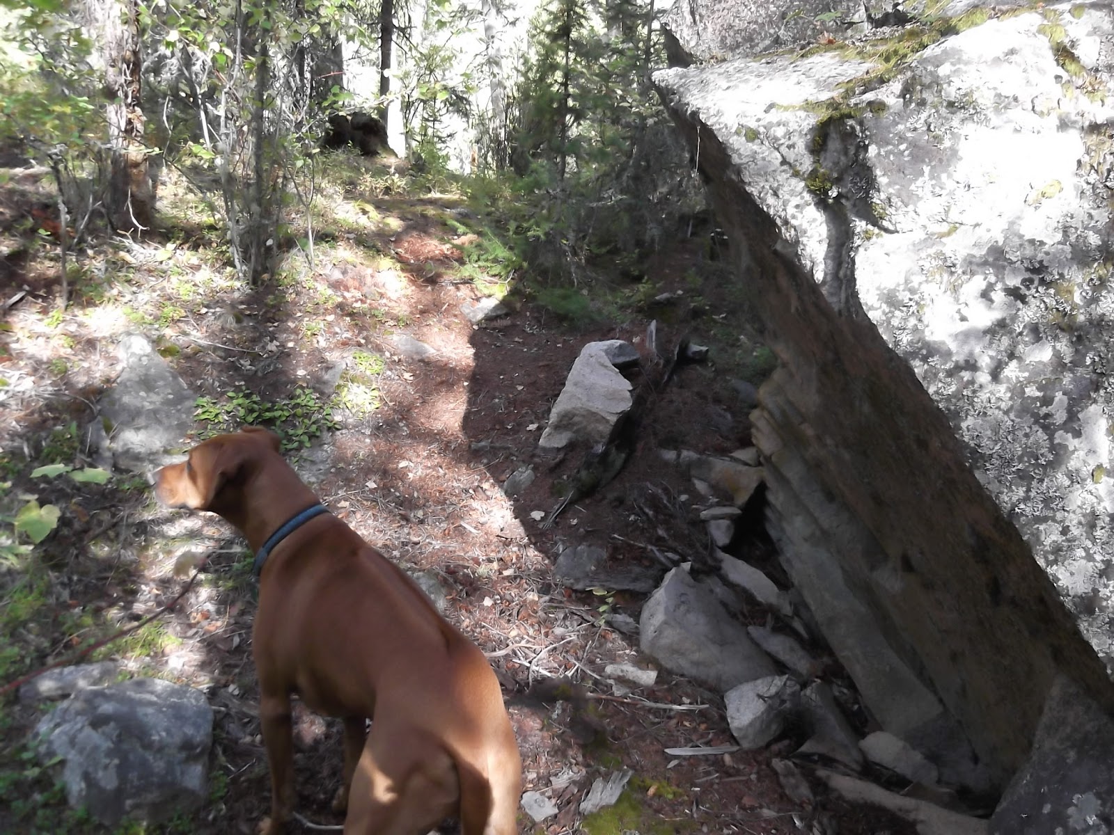
The reality is the area gets so little traffic (would venture to guess the CDT proper probably sees less than 100 bikers a year due to ride season based on snow pack, etc).  We saw ample evidence of horses on the trail and they really trash a trail quickly.

Alas, the never-ending debate of horses and bikers.  The reality is that areas like this see so little traffic for any user type that it would be pretty silly to close it down to any specific user group (motorized not-withstanding as they should be kept out in order to maintain the pristine nature of the area).

oopsy - took a left turn on the way of the post - back to the weekend.  The good thing is that while the government spends their resources trying to figure out what to do, it creates a window for some essplorin'.

The campground was desolate - we were the only ones up there and the area was pretty quite.  The foliage is turning and in some areas, it made for very vivid and bright scenery.

The riding was rugged, tough, technical, but super scenic.  There is no easy way to manage loops on the trail since most of the trail is point to point but there are ways to link together segments if you are willing to spend some time riding on dirt roads to get back to where you started.    We managed logistics via a shuttle car but still ended up putting some road miles in to get to the car.

We ended up not going as far as we had planned mostly due to the aggressive nature of the trails.  The trails take longer to ascend and descend with a lot of gnarly rocks that can make progress slow.  I can see how it would be a good idea to make sure to pack extra (in addition to the extra you should carry) tubes or perhaps even tire as some of the sharp rocks and erosion control (sharper yet) that the trail coughs up.

The trail must have taken a lot of work to build as there are sections that were slightly elevated to avoid the swampy marshy meadows & run-off.

We ended up riding 28 miles which produced around 3,500 ft of elevation gain.  The elevation gain is a little misleading because most of it came on two short sections as you can see from the elevation profile:
Those steep little point sections included some serious grunting and hike a bike to summit on a couple of saddles around 9,200 ft.  If you look at the profile, you can tell you climb around 1000 ft in 2 miles to gain the saddle!

The topo shows
I am looking forward to getting back out there at some point for further exploration but this was a great taste of what that area offers.  Fantastics views but certainly not a trail for the meek or timid and don't be afraid of steep technical ascents and descents with an occasional hike a bike thrown in for good measure.

Pictures forthcoming in tomorrow's blog....

Friday, September 23, 2011

BC Bike Race - Photog Pix

The wifer surprised me a while back and purchased some of the pix taken by the BCBR photogs...here they be:


Thursday, September 22, 2011

Bitterroot Stone

As we rode in the Bitterroots this past weekend, I constantly had my eyes peeled for rock.  As a climber (ok, former climber who is hoping to get back into the climbing swing at some point again), your eyes are always scanning terrain for stone.  There is some bouldering north of where we were camped up in the Lost Horse area but given all the rock we rode through, there has to me a lot more just waiting to be developed.

I think there is probably a fair amount of easily accessible bouldering that could be knocked off.  There possibilities are there...heck, we saw this boulder around the campsite - it has 3 different faces that each had problems on it!

Picture of the front side - note that it is steeper than it looks...
 side portrait of the same face above - good holds, good topouts, ok landing
 side of the boulder....needs some cleaning but possibilities are there
 another steep little face - probably only a 2-4 move problem but good starting holds...
A couple of gratuitous puppy shots - the dogs had a blast exploring new territory and squirrel chasing:
Moby wondering what is taking us so long....
 Otis checking water depth
 part of the trail we rode on Saturday - where there is little rock, there bigger brothers and sisters lurk....Generally, the stone looked like it was pretty good quality with good texture - looking forward to getting back and doing more exploring at some point, and hopefully up to Lost Horse to boulder....

Wednesday, September 21, 2011

MTB: Sula Nat Forest

The upside of taking a few wrong turns on Saturday was that we got to see and ride a lot more than what we had planned originally.  We were originally going to stay in the same area to ride but we ended up riding most of what was on our original plans on Saturday as opposed to over 2 days.  There is tons more riding to explore in the area but we wanted to taste something a little different without having to commit to a big climb or big loop.

We ended up heading back over to the Chief Joseph Pass area and did an out & back where we hooked into the trail junction to the CDT.  We meandered along a creek for a few miles and then the trail veered off to the right and got steep!  It was a stroll in the park until the pitch kicked up and put the hammer down.  The grade was not un-rideable, but the combo trail and trail state made a couple of spots rather difficult to ride and ended up resorting to a little hike a bike.

Along the way we checked out the USFS cabin in the meadow and then continued on up the trail.  Fall is in the air and the colors of the leaves are changing.  It will be prime time over the next couple of weeks as the days get shorter.
After our lost medley day on Saturday, it was nice to do an easy out/back with not turns to worry about and no route to figure out.  It definitely got me geeked about going back and exploring more though - there is just so much to check out that way.

We ran into several hikers who were all super chatty.  We also ran into a Forest Service lady who was super nice and told us the last person to stay at the cabin in the meadow saw a moose & bear so the critters are definitely around.

Here is the junction to the CDT:
 heading down towards the Pass:
 heading back up from the Pass direction:
 along the creek:
 one of the little meadows along the creek:

Monday, September 19, 2011

MTB: Bitteroot Lost Medley

As the Fall closes in on us, the mad scramble to squeeze every ounce of good weather and daylight is on! We loaded up the Airstream on Friday and busted out to the Bitterroot Valley to explore some riding in the area.  I had been looking at maps and talking to to folks to get beta and there seem to be a lot of great riding to be had.

Shortly after the wifer got home, we were on the road and like the Blues Brothers, we were on a mission, albeit a different one than theirs.  Fortunately, the camping area was really quiet and we were able to find a site all to ourselves with no neighbors around so it gave the dogs plenty of space to run around and tree squirrels all weekend.  I think the change in weather has deterred people from going out because the campsites were not busy and the trails even less so.  We did talk to some equestrians and one other biker but if felt like we had to the trails to ourselves once again.

It worked out well because it was cool enough that we were able to leave the dogs in the airstream while we rode and when we got done the weather and recent frosts had pretty much eliminated all signs of mosquitoes.

We headed out on Saturday with the intention of going on a ride for about 16-20 miles....We missed a couple of trail markers (that were not exactly well placed - as in, under some branches after a critical junction - as opposed to at a junction) and the ride turned into a 34 mile jaunt through most of the trails in the immediate area.  The benefit was that we got to see a tick off a bunch of awesome riding!  I call it the Lost Medley due to all the back-tracking we did but it was worth all the epicness that ensued!
The views were just spectacular.  The low point of the ride was around 4,400 ft while the high point took us to about 7,700 ft.  There was a lot of climbing on the day (around 5,300 ft) and some of it was of the steep butt kicking type! 

We started along a creek-bed for a few miles...rocky and a little tekkie in places - snaked up the valley
 ran into this USFS cabin about 6 miles in
 continued up the valley
 back into the trees - that slope must stay really wet based on the lichen on the trees
 gained the summit saddle (where we missed our turn for our original laid out ride)
 rode through some burn areas:
 then eventually back-tracked over to where we were supposed to go
 and the descent was ON
 great Fall colors through the burn - amazing how lush the undergrowth was in the burn areas!
 Gotta' love a trail that you can see winding below you...WOOHOO
All in all, it was a long, but very good day...enough to want to go back and explore some more.  We got a lot of riding in but there is TONS more to be had...