Following are some trail descriptions for local riding around Butte, MT
 CDT - Homestake Pass to Toll Canyon
Trail Type: Singletrack - Out and Back
Technical Difficulty (1 to 10): 5
Physical Difficulty (1 to 10) : 6
Distance: 17 miles
Elevation Gain: 2,700 ft
Trail Access: Heading East from Butte on I-90, take the Homestake Pass exit and when the exit ramp comes to a T, the trailhead will be immediately in front of you.

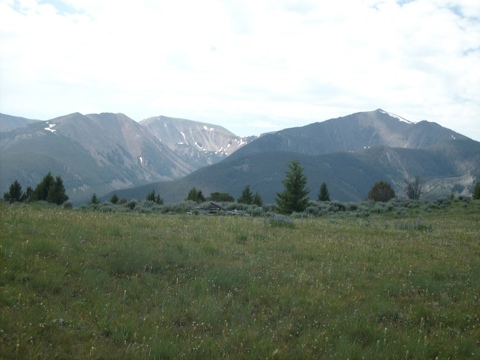
Trail Description: This section of the CDT starts right off the freeway (don't let that deter you as the trail is Top Notch). The trail winds up and over the Continental Divide. It is a superb, flowy, scenic, fast, steep (in places) and just what singletrack trail should be...nice and tight! There are a couple of scenic viewpoints that open up with great views of Butte, the Highlands, and the Pintlers in the distance.
Trail Options: You can turn around at the high point and head back for a super fun descent. Once you get to the Beaver Ponds intersection you can make a sharp right turn (heading north) and link up to the Beaver Ponds trail(s). As an out & back trail, you can make this as long or as short as your legs let you.
Topo:


Trail Access: Take the Homestake Pass Exit on I-90. Trailhead will start on the north side of the freeway on the left (west) as you drive north
Trail Description: The first couple of miles force you to warm up fast and get your legs moving and your mind into climbing mode. You will gain a lot of elevation in the first 3 miles of this trail. Be ready to climb climb climb until you hit a scenic viewpoint that will offer a quick rest and photo opp. Once you have had your Kodak moment, it is time to move on and continue to climb over the next few miles (albeit a much easier grade). At mile 8, you crest on a little ridge where you have great views of Whitehall. You will descend via switchbacks to an opening that is the turn-around point. Head back up the switchbacks and get ready for a rolling, rollicking, fun descent that just puts a smile on your face from ear to ear.

Trail Options; At the turn around point, you can bushwhack your way back down one of the gulleys back into Maude S Canyon where you can ride established trail back down the Maude S Canyon parking area. Note that this will put you about 6 miles from your car at Homestake Pass - so be prepared to shuttle or ride back up (with a 1000 ft climb) the rail road bed or freeway. The out & back option really is so much fun on the return that it is a little bit of a waste to head back down via Maude S (not to mention adding logistical complexity!).


Trail Type: Singletrack - Out and Back
Technical Difficulty (1 to 10): 5
Physical Difficulty (1 to 10) : 6
Distance: 17 miles
Elevation Gain: 2,700 ft
Trail Access: Heading East from Butte on I-90, take the Homestake Pass exit and when the exit ramp comes to a T, the trailhead will be immediately in front of you.

Trail Description: This section of the CDT starts right off the freeway (don't let that deter you as the trail is Top Notch). The trail winds up and over the Continental Divide. It is a superb, flowy, scenic, fast, steep (in places) and just what singletrack trail should be...nice and tight! There are a couple of scenic viewpoints that open up with great views of Butte, the Highlands, and the Pintlers in the distance.
Trail Options: You can turn around at the high point and head back for a super fun descent. Once you get to the Beaver Ponds intersection you can make a sharp right turn (heading north) and link up to the Beaver Ponds trail(s). As an out & back trail, you can make this as long or as short as your legs let you.
Topo:

Elevation Profile:

CDT - East Ridge

Trail; Type: 90% singletrack / 10 % doubletrack - Out and Back
Technical Difficulty (1 to 10): 6
Physical Difficulty (1 to 10): 7
Distance: 14-18 miles depending on turnaround point
Elevation Gain: 2,600-2900 ft
Trail Access: Take the Homestake Pass Exit on I-90. Trailhead will start on the north side of the freeway on the left (west) as you drive north
Trail Description: The first couple of miles force you to warm up fast and get your legs moving and your mind into climbing mode. You will gain a lot of elevation in the first 3 miles of this trail. Be ready to climb climb climb until you hit a scenic viewpoint that will offer a quick rest and photo opp. Once you have had your Kodak moment, it is time to move on and continue to climb over the next few miles (albeit a much easier grade). At mile 8, you crest on a little ridge where you have great views of Whitehall. You will descend via switchbacks to an opening that is the turn-around point. Head back up the switchbacks and get ready for a rolling, rollicking, fun descent that just puts a smile on your face from ear to ear.

Trail Options; At the turn around point, you can bushwhack your way back down one of the gulleys back into Maude S Canyon where you can ride established trail back down the Maude S Canyon parking area. Note that this will put you about 6 miles from your car at Homestake Pass - so be prepared to shuttle or ride back up (with a 1000 ft climb) the rail road bed or freeway. The out & back option really is so much fun on the return that it is a little bit of a waste to head back down via Maude S (not to mention adding logistical complexity!).
Topo:

Elevation Profile:

 Trail; Type: 30% singletrack / 30 % doubletrack / 40% road - Loop


 Elevation Profile:


 Elevation Profile:
 Trail Description: Head back towards Butte on Continental Drive and turn right at the first paved road. Climb up the steep hill and you will see a parking area with a sign for ‘Blacktail Canyon’. Continue climbing up, up, up and stay right when you reach a Y junction. Follow the signs to the Beaver Ponds. Connect into the CDT and continue on the CDT….cross Hwy 2, stay on the CDT, head up the Toll Canyon portion of the CDT until you come to a junction, where once again you turn right and keep following the signs for the CDT.
 Elevation Profile:
 Elevation Profile:

CDT - Burton Parkway / Basin Creek CDT
 Trail; Type: 30% singletrack / 30 % doubletrack / 40% road - Loop
Technical Difficulty (1 to 10): 6
Physical Difficulty (1 to 10): 6
Distance:
Elevation Gain:
Trail Access: Take Hwy 2 South of Butte until Roosevelt Drive. Turn on Roosevelt drive (only 1 way to turn). Follow the paved road up until it turns to dirt. Where it turns to dirt, there will be a pullout with some mailboxes and newspaper slots. Park in the grass area and start the ride from here heading up the dirt road.

Trail Description: Take the road up, climb around 5 miles until to peak. If you look east, you will have a great view of the Highlands. Look for the CDT sign and follow the faint trail until you hit a more established trail. The CDT singletrack will take you through the Basin Creek drainage area where you will have a couple of climbs. The trail is FUN with some steep climbs to keep you honest and some great, fast singletrack. The trail will T. Turn R at the T and watch for the occasional 4-wheeler. You continue to drop through some super fast double track. Be careful as some of this is rutted out and a bad line could mean a serious yard sale. Once you finish the descent, you take the dirt road back towards Butte, take a R on Herman Gulch and follow the signs to Herman Gulch - there will be a couple of short punchy climbs. Once you come out at a trail junction, take the double track/road and head up the hill until it drops you onto a paved road. Take that paved road for a couple of miles back to the car.

Trail Options: You have all sorts of link up options. You could start in the Thompson Park area, ride up to Herman Gulch, do the same ride, and then exit back out of Thompson Park once you get back to Herman Gulch.
Topo:

Elevation Profile:

CDT – Nez Perce to Pipestone

Trail Type: 40% Singletrack / 35% Doubletrack / 25 %Road – One way, Shuttle needed
Technical Difficulty (1 to 10): 7
Physical Difficulty (1 to 10) : 7
Distance: 23 miles
Elevation Gain: 2,700 ft
Trail Access: Finish: Leave a car at the Pipestone Exit on I-90. Heading East from Butte on I-90, take the Pipestone exit and turn left off the ramp. There will be parking on the north side of the access road. Start of ride: Go north from Butte on I-15 and take the Elk Park exit. Turn right off the exit and head back on the access road on the direction you just came. Turn left on a dirt road and follow that road for about 3 miles until you reach an opening where you can park the car. There is a CDT sign where the trailhead begins.
Trail Description: This trail start to climb pretty quickly and there are sections that are steep and somewhat technical. A couple of sections pack a mean little punch but they are not sustained so soon enough the grade subsides. You feel a little more remote on this trail which can be a lot of fun! Stay on the CDT and follow the signage for the CDT. When you come to a T junction, turn left and continue down to Pipestone where the trail starts to open up into double track and road. These sections can be very fast and really tricky if you don’t look far enough ahead – look into the bad lines on the double track and your wheels will follow! It could turn into a yard sale very quickly! Pick your poison on the combo of trails/road to get back to the 4 corners junction and pick your poison to get back to the car. It is best to go with someone who has done this before as there are hundreds of miles of trails/roads that are heavily used my motos. Worst case, you can always ask for directions to get back to the RR crossing. Once you get back to 4 corners, you can continue down trails back to the RR crossing and once at the RR crossing, take the gravel road back to the car.
Trail Options: For an uber burly ride, you can park down at Maude S and take double track all the way up to Elk Park (about10 miles with around 1,000 ft of climbing) and then catch the trailhead as you would when driving there. There are also plenty of options to lengthen the ride around Pipestone proper.
Topo:


Thompson Park Loops/Gateway

Trail Type: 90% Singletrack / 10% RR bed
Technical Difficulty (1 to 10): 5
Physical Difficulty (1 to 10) : 6
Distance: from 5 to 30 miles – as much as you want
Elevation Gain: Depends….low point of park is 5,500 ft, Highpoint 6,500 ft...as per the topo below, 4,000 ft of elevation gain
Trail Access: Head South from Butte on Continental Drive until you get to the junction with Hwy 2. At this junction there will be parking on your left, or if you continue on Hwy 2, there will be 3 pullouts on your right that all give you access to the Thompson Park network of trails.
Trail Description: The trails are generally in great shape – due to their lower elevation they tend to dry out first in the area. There are lots of tight turns with fun descents. Be aware that you have to constantly be ready to brake or else a surprise turn might lead you into the trees or catching some un-intended air time.

These trails are mostly singletrack with some double track and RR bed. There are trails below the RR bed, and trail above it. The trails can be easily connected via the RR bed. If you stay on the railroad bed, you might go through 2 tunnels where you have to ride by ‘feel’ as you can’t see anything. Staying on the railroad bed heading south will connect you into the Toll Canyon section of the CDT. Connecting the trails above the RR bed will connect to Herman Gulch where you can either take other trails back towards the RR bed or head up Hermacn Gulch to connect to different trails. The Thompson Park system easily connects into the Archery Range from the middle parking lot, or Herman Gulch, or Toll Canyon CDT, or Beaver Ponds CDT. This is the middle piece of the puzzle that enables easy trail connections between existing trail systems!
Trail Options: Too many to list (see above trail description)– you can ride all day long and link back into the Thompson Park system if you need to re-stock on water, carbs, etc.
Topo:


CDT - 8 Miles of Ruffage
Trail Type: 80% Singletrack / 20% Road
Technical Difficulty (1 to 10): 7
Physical Difficulty (1 to 10) : 7
Distance: 28 miles as described
Elevation Gain: 4,900 ft
Trail Access: Head South from Butte on Continental Drive until you get to the junction with Hwy 2. At this junction there will be parking on your left. Park and start the ride here/
 Trail Description: Head back towards Butte on Continental Drive and turn right at the first paved road. Climb up the steep hill and you will see a parking area with a sign for ‘Blacktail Canyon’. Continue climbing up, up, up and stay right when you reach a Y junction. Follow the signs to the Beaver Ponds. Connect into the CDT and continue on the CDT….cross Hwy 2, stay on the CDT, head up the Toll Canyon portion of the CDT until you come to a junction, where once again you turn right and keep following the signs for the CDT.
Shortly afterwards, you will cross a road (Lime Kiln Road) and this is where the 8 mile of Ruffage reference starts. Up until now, you have enjoyed smooth, buff, dreamy trail…get ready for a rude awakening. The next 8 miles include rolling climbs with steep tekkie sections that will leave you reminiscing about the flow of what you just left (and will soon enough return to). Once you are into this 8 mile section you will go into a small grassy meadow with stupendous views of the Highlands…take it in for a few moments and prepare yourself for more of the same bouncing around in a washing machine with a couple of bowling balls….ok ok, truth be told the section is not that bad but we are so spoiled with a super buff trails that we forget we sometimes have to put on our big boy/girl pants and ride! Keep following the CDT signs when you get to any junctions until you hit a dirt road. Once at the dirt road, you can either head down the road for 5 miles and connect into the top of Herman Gulch or take the longer ride option and continue on the CDT and eventually loop back into Basin Creek. Once you hit Herman Gulch, you will reach a junction where all trails heading north or east will take you back into the Thompson Park network where you continue to let gravity do its things and roll you downhill back to your car. The trails will all eventually lead you to the recreation areas in Thompson Park where you can easily catch Hwy 2 back to the car – there is a trail that you can take that parallels Hwy 2 and is below the RR bed (it is accessed from the southern most parking lot ,where the trail heads north towards Butte – keep heading downhill until that trail kicks you out mere yards away from your car).
Trail Options: Upon exiting the 8 miles of Ruffage, you can stay on the CDT and descend via Burton Parkway into Basin Creek, and back over to Herman Gulch.
Topo:


Toll Beaver Fish Figure 8
Trail Type: 90% Singletrack / 10% road
Technical Difficulty (1 to 10): 6
Physical Difficulty (1 to 10) : 7
Distance: 17 miles
Elevation Gain: 3,900 ft
Trail Access: Head South from Butte on Hwy 2 until you start going uphill towards Pipestone Pass. Before you reach the Pass proper, you will see a pullout on your left with a sign that says “Beaver Ponds’. My preferred option is to park here and start the ride from this pullout
Trail Description: Head up-hill on Hwy 2 for a little over a mile until you reach the pass and then take a sharp right onto the CDT trail (there will be a sign at the trail-head). Enjoy the nice and smooth 4 miile climb that occasionally gives you awesome views towards Butte/Pintlers, and on other occasions opens up with big views of the Highlands. Follow the CDT up to the first junction and bear right – stay on the marked CDT trail and it will pop you out onto Lime Kiln Road. Turn left here (if you continue across the road, you will venture into the 8 miles of Ruffage). Go up a short punchy climb and look for remnants of a trail on your left as you peak. At this point you might want to stop, pull out a camera and have another Kodak moment since the Highlands are in full plumage (if mtns can indeed be in plumage, but alas I will take some liberties) from this location. If you start to go downhill, turn around as you have missed the trail.
Follow the trail down through the Fish Creek drainage and enjoy the lesser known trail that does not get much traffic. It is fast and super fun…try to lay off the brakes as much as possible and let gravity take over – once at the bottom of the trail, wipe the bugs off your teeth (from that ear to ear grin) and cross the creek (usually rideable). Once you have crossed the creek, you will immediately be on another trail, Turn left and go uphill where a series of switchbacks will take you back up to catch the Toll Canyon section of the CDT. Follow this very fast and flowy section back to Hwy 2 where you can take a sharp right turn by the trailhead and stay on the trail as it parallels Hwy 2. Cross Hwy 2 and continue toe buff riding until you hit a junction. At that junction, bear left and follow the trail back to the car. Don’t take any spurs towards the Beaver Ponds proper where you end up crossing the Beaver Ponds or you will end up over towards Blacktail Canyon. After more ear to ear grinning the fun eventually ends and you pop out at your car.
Trail Options: At the bottom of the Fish Creek descent, you can take a right (instead of left and going back uphill) and continue the descent which pops you out onto Hwy 2. At this point you can either ride the RR bed back up or just ride Hwy 2 about 3 miles back to the intersection where the CDT crosses Hwy 2 and turn right to hook into the Beaver Ponds trail system
Topo:


No comments:
Post a Comment